There may not be any National Parks in Wisconsin, but the state isn’t lacking in National Park System entries. Learn about all four.
Out of the 63 National Parks spread throughout the United States, a vast majority are located in the western part of the country, with five in Utah, eight in Alaska, and nine in California alone. The ones that are located in the Midwest are few and far between—only eight in total—with no National Parks in Wisconsin. However, just because there are no National Parks in the state, that doesn’t mean that there aren’t any entries in the National Park System.
While there are 63 National Parks throughout the country, there are more than 433 entries within the National Park System, which includes National Lakeshores, National Scenic Trails, National Scenic Riverways, National Historic Sites, National Monuments, among several other designations. Altogether, Wisconsin has four entries in the National Park System, including a National Lakeshore, two National Scenic Trails, and a National Scenic Riverway, which offer a scenic way to enjoy some of the state’s best outdoor offerings.
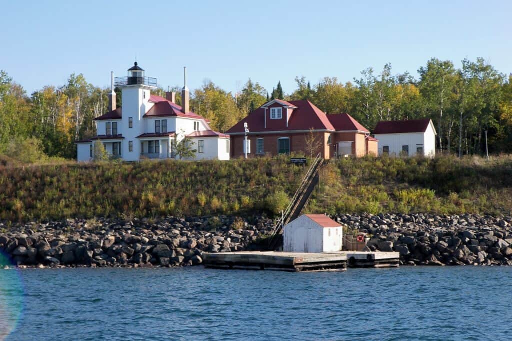
Apostle Islands National Lakeshore
415 Washington Ave., Bayfield
Entrance Fee: Free, but fees for parking in some locations, camping, and third-party ferries
Off of Wisconsin’s northern Bayfield peninsula are the Apostle Islands, a group of 22 islands in Lake Superior, that make up some of the most scenic coastline in the state, and 21 of the islands make up the Apostle Islands National Lakeshore. Visitors to the lakeshore can hike, camp, kayak near the islands, scuba dive, and visit the ice caves in the winter. The island’s ice caves form near Meyers Beach, but it’s a rare opportunity to be able to explore them—there have to be the perfect winter conditions, with low winds, persistent subzero temperatures, and thick ice. The ice caves haven’t been open to the public since 2015.
Madeline Island, the largest of the Apostle Islands, is not included as part of the National Lakeshore because of its commercial businesses and larger population. There’s currently a bill pending in Congress to change the Apostle Islands National Lakeshore into Wisconsin’s first National Park, but there is growing opposition to the proposed park from local residents, because it would limit hunting opportunities and bring in more tourists to the area, which doesn’t have the infrastructure to support an influx of tourism, according to Bayfield Mayor Ted Dougherty.
The lakeshore is one of just three National Lakeshores, with the other two, Pictured Rocks and Sleeping Bear Dunes, both located in Michigan. The National Lakeshore’s main headquarters is in downtown Bayfield, in the city’s old Bayfield Courthouse Building, but another seasonal visitor center showcases the history of the Lakeshore’s Little Sand Bay.
Ice Age National Scenic Trail
N2875 WI-67, Campbellsport
Entrance Fee: Free, but some public lands along the trail may charge an entrance fee
From north to south, Wisconsin is 320 miles long, and at its furthest eastern and western points, the state is 295 miles wide. It doesn’t seem like a 1,200-mile-long trail could fit within it, but the Ice Age National Scenic Trail proves that idea wrong. The trail, which is entirely located within Wisconsin, traverses up, down, and across the state, totaling 1,200 miles of trail. The trail’s two trailheads are in Potawatomi State Park, in Door County, and near Interstate State Park, along the state’s border with Minnesota.
The trail is one of 11 National Scenic Trails, along with the Appalachian Trail, Pacific Crest Trail, and Continental Divide, after first becoming a unit of the National Park System in 2023. It follows the terminal moraine, or the edge of a glacier, from the last Ice Age, which created Wisconsin’s distinctive landscape of rolling hills, lakes, wetlands, kettles, and moraines. The trail can be hiked in its entirety, which typically takes several months, or casually hiked in sections. Visitors can also camp, hunt, and fish along the trail.
The scenic trail doesn’t have any visitor centers that are operated by the National Park Service, but there are state-run visitor centers, including the Henry S. Reuss Ice Age Visitor Center in Campbellsport.
North Country National Scenic Trail
229 East Main St., Lowell, Mich.
Entrance Fee: Free
The North Country National Scenic Trail spans approximately 4,800 miles, from the western edge of Vermont all the way to the middle of North Dakota, and a stretch of that passes through northern Wisconsin. The trail, which is the longest trail in the U.S. The National Trails system, spends approximately 215 miles passing through the state, including through several state parks and the Saint Croix National Scenic Riverway.
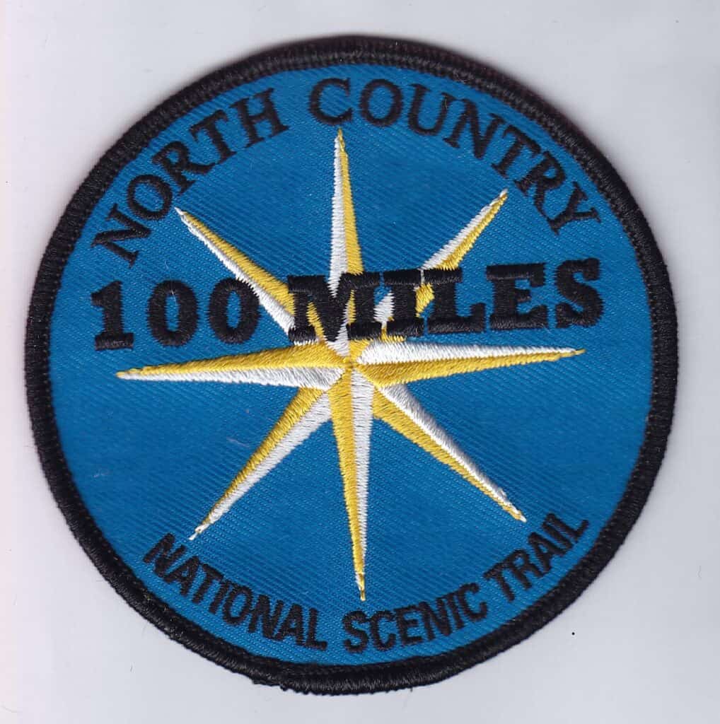
One of the activities that hikers along the trail enjoy is collecting North Country National Scenic Trail passport stamps at locations across the trail’s thousands of miles. Hikers can purchase passport stamp books online or at any National Park System Visitor Center and get them stamped at locations throughout the trail, including several in Wisconsin, like the Brule River State Forest Headquarters, Pattison State Park Visitor Center, and the Copper Falls State Park Visitor Center. Hikers can also take part in the North Country Trail Association’s Hike 100 challenge, where they can log their miles and receive a patch if they’ve hiked more than 100 miles on the trail within a calendar year.
The trail’s main visitor center is located in Lowell, Mich., although the National Park System does not operate it; instead, it’s managed by the North Country Trail Association, one of the primary organizations that develops and maintains the lengthy trail.
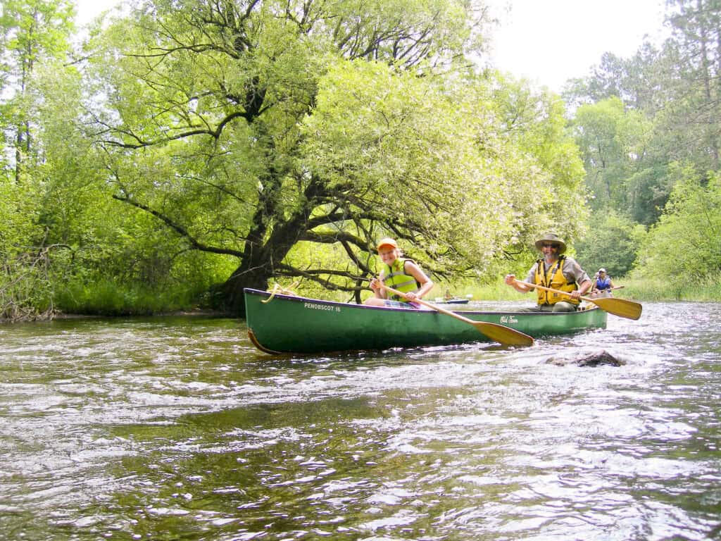
Saint Croix National Scenic Riverway
401 North Hamilton St., St. Croix Falls
Entrance Fee: Free
More than 200 miles of riverway make up the Saint Croix National Scenic Riverway, which has been a nationally recognized and protected natural area since the ’60s. The riverway is made up of both the St. Croix River, which runs along the Wisconsin and Minnesota border, as well as one of its tributaries, the Namekagon River, which is solely based in Wisconsin. In 1968, Congress began designating National Wild and Scenic Rivers, and the Saint Croix National Scenic Riverway was one of the first to be designated on Oct. 2, 1968.
There are several locations along the river where visitors can rent watercraft such as kayaks to explore the rivers on their own, or they can take part in programs led by Wild Rivers Conservancy staff, like guided hikes or kayaking day trips. Visitors can also spend time fishing, camping, and hiking alongside the river.
The National Scenic Riverway has two visitor centers, which operate seasonally in both St. Croix Falls and Trego. The St. Croix Falls visitor center is open until November, while the Trego one shuts down for the season after Labor Day. The visitor centers offer an opportunity to join the National Scenic Riverway’s Junior Ranger program, learn from river exhibits, and get help planning their trip along the river from park rangers.