From Northern Virginia to Southwest Virginia, here are some of the most stunning frozen waterfalls in the state.
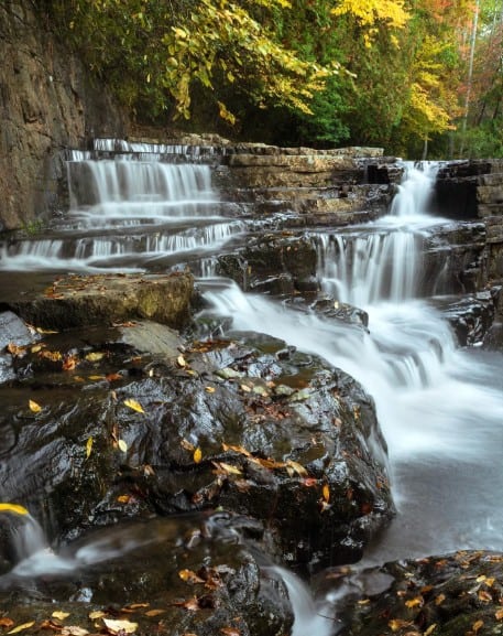
When cold snaps settle over Virginia, some of the Commonwealth’s most beautiful waterfalls take on a new, often short-lived, form. As the rushing water stiffens into icicles, breathtaking frozen waterfalls emerge. Although fully frozen waterfalls are rare because of the prolonged need for chilly temperatures, partially frozen waterfalls are still well worth the trek. If you’re hoping to catch a glimpse of a frozen waterfall this year, try one of these 18 gorgeous winter hikes in the Commonwealth.
Northern Virginia
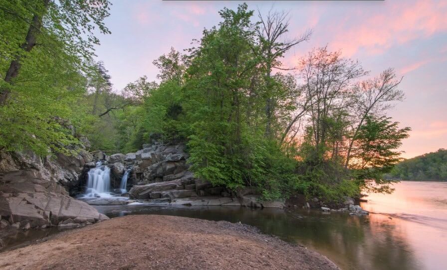
Scotts Run Waterfall
GPS coordinates: 38.9588, -77.20503
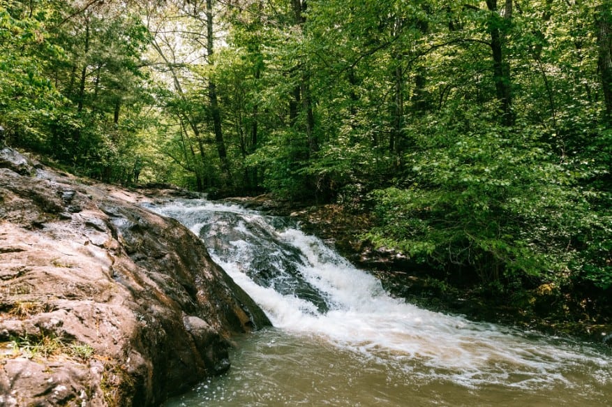
The Scott’s Run Waterfall can be found in the 400-acre Scott’s Run Nature Preserve, not far from McLean. It forms near where Scotts Run empties into the Potomac River. Look for the nearby ruins of Burling Cabin to confirm you’re in the right place.
It’s less than 2 miles to hike to the waterfall and back. Plan to go on a more rugged hike than most other trails in the Fairfax County Park Authority system. The preserve has two entry points, both of which can be found off Georgetown Pike.
Shenandoah Valley
Overall Run Falls
GPS coordinates for trailhead: 38.76278, -78.27973
Overall Run Falls certainly isn’t a disappointment, given that it’s Shenandoah National Park’s highest set of falls. First, look for Twin Falls, where a boulder divides Overall Run. This causes the water to pour out into two distinct channels that drop by 29 feet. If you have enough time, continue for another quarter mile to see Overall Run drop by another 93 feet into a canyon.
The hike to the falls and back is about 6.8 miles over moderate to difficult terrain. Front Royal is the nearest town to the falls.
Hazel River Falls
GPS coordinates for trailhead: 38.6382, -78.31381
While at Shenandoah National Park, you can stop by Hazel River Falls as well. Located near Luray, it’s a 2.7-mile hike to the falls on paths previously used by settlers, but with a small portion that’s a bit steeper. A rock shelter opens to the waterfall where the Hazel River follows a slender 25-foot drop into a plunge pool.
Whiteoak Canyon
GPS trailhead coordinates: 38.53933, -78.34916
If you’re looking to see as many frozen waterfalls as possible in one hike, then Whiteoak Canyon is for you. An astonishing six falls can be found along the moderate-to-difficult Whiteoak Canyon Trail near Madison in Shenandoah National Park. As a bonus, smaller waterfalls are also sprinkled throughout the trail on Whiteoak Run.
Keep track of your miles so you’ll know when you’ve reached Whiteoak Falls (no. 1). It’s a 2.7-mile hike to it, and Whiteoak is known as being the second-highest fall in the park, dropping 86 feet.
Dark Hollow Falls
Dark Hollow Falls is a collection of cataracts not far from the Big Meadows Area of the Shenandoah National Park near Luray. You’ll want to follow the Dark Hollow Falls Trail to see Hogcamp Branch as it makes its way down to the Rose River. Each fall empties into deep plunge pools. The total distance is 70 feet.
The 1.8-mile hike to and from the falls is relatively easy.
South River Falls
GPS trailhead coordinates: 38.38105, -78.51684
Plan to spend a little extra time at South River Falls because the 83-foot waterfall can be viewed from multiple vantage points, including where the water from the South River divides into two chutes before pouring downward or from the base of the falls.
With the nearest town being Elkton, it takes 4.2 miles to hike to and from the falls on the moderately difficult terrain. If the weather is nice, plan to take a break and enjoy a snack at the nearby South River Picnic Area.

Doyles River Falls
GPS trailhead coordinates: 38.25415, -78.68291
Doyles River Falls, also near Elkton, offers the chance to see two waterfalls. The first fall features a three-tiered 30-foot drop, which can be viewed at the base of the plunge pool. The lower fall is much steeper, dropping 63 feet. Given that the water drops over a rock lip, it ends up creating lively channels as it makes its way into the plunge pool below.
It’s a 3-mile moderate hike to Lower Doyles Falls and back.
Mine Bank Cascades
GPS trailhead coordinates: 37.91113, -79.08974
If the waterflow of Mine Bank Creek in Saint Mary’s Wilderness has been higher ahead of the freezing, the Mine Bank Cascades are well worth visiting. Unique in the fact that they’re slide-type waterfalls, the largest is a 60-foot-long slide.
Near Steeles Tavern, the easy trail to the cascades covers 1.4 miles.
Saint Mary’s Waterfall
GPS trailhead coordinates: 37.92516, -79.13758
Saint Mary’s Waterfall, also in Saint Mary’s Wilderness, is where the Saint Mary’s River drops by 25 feet in a curtain-like formation before hitting a rock and flowing into the plunge pool below.
The 0.9-mile hike to the waterfall is over easy terrain. The closest town is Steeles Tavern.
Apple Orchard Falls
GPS trailhead coordinates: 37.50781, -79.52412
The 2.6-mile round-trip hike to Apple Orchard Falls is worth the effort, given that you’re able to see a collection of cascades in one place. The destination features small cascades, a larger cascade that goes over a ledge before going down an angled chute, and a big cascade with a boulder in the middle of it that causes the water to spill in multiple directions.
The falls, which are near Sedalia, are accessible from the Blue Ridge Parkway. The trail is classified as being moderate in difficulty.
Falling Spring Falls
GPS trailhead coordinates: 37.86762, -79.94783
Cross your fingers that Falling Spring Falls are frozen when you visit. The falls are so famous that native Virginian Thomas Jefferson compared them to Niagara Falls. Although they aren’t as dramatic as the famous Niagara Falls, they still drop an impressive 170 feet. First, the water hurls off a bluff that’s 70 feet deep, then rolls off another 100-foot cascade.
Lucky for non-hikers, the falls are easily accessible from a pull-off outside of Covington. Be advised that you aren’t allowed to venture past the overlook for a closer look.
Central Virginia
White Rock Falls
GPS trailhead coordinates: 37.90799, -79.05166
Although White Rock Falls is considered a small-volume waterfall, it can be quite captivating when the water of White Rock Creek freezes along the 30-foot descent into the pool below.
The falls, which are near Massies Mill, can be accessed from the Blue Ridge Parkway. It’s a 0.9-mile easy hike to the falls.
Crabtree Falls
GPS trailhead coordinates: 37.85104, -79.07992
Don’t miss your chance to see Virginia’s highest waterfall, Crabtree Falls near Montebello. It consists of five major falls, in addition to smaller waterfalls, that drop an astonishing 1,200 feet in just half a mile. There’s even one fall that drops by 500 feet.
To access the falls, follow Crabtree Falls Trail along the Tye River over moderate terrain. It’s a 5.4-mile hike to and from the falls.
Southwest Virginia
Waterfalls of Falls Ridge Preserve
GPS trailhead coordinates: 37.19321, -80.32147
Multiple drops create a stairstep effect of roughly 80 feet at the waterfalls of Falls Ridge Preserve. The unique effect is the result of the area being one of the world’s largest exposed calcium carbonate deposits. The largest drop is 30 feet. The water from it collects in a pool before spilling into various rapids. Depending on the flow of the water at the time of freezing, different parts of the ledge may have more ice on them than others.
The round-trip hike to the falls covers 0.8 miles outside of Ironto.
Cascade Falls
GPS trailhead coordinates: 37.35359, -80.59942
Cascade Falls near Pembroke features a cataract that drops 60 feet over a stone cliff. It empties into a plunge pool that’s surrounded by rock walls. Given the openness of the area, the falls can be viewed from multiple vantage points.
The trail to the falls consists of a 4-mile round trip over easy to moderate terrain.
Dismal Falls
Trailhead GPS coordinates: 37.18845, -80.90035
Spanning 50 feet in length, Dismal Falls is where Dismal Creek drops by 10 feet into a plunge pool. Uneven, the left side follows a stairstep formation; however, the middle and right sides feature a curtain-like drop pattern. The falls can be viewed from lengthy stone terraces.
Near Bland, it only takes a 0.1-mile hike to the falls.
Little Stony Falls
GPS trailhead coordinates: 36.86943, -82.46353
Visit Hanging Rock Recreation Area near Dungannon to see a variety of small cascades and mid-sized falls at Little Stony Falls. Over the course of the 2.4-mile round-trip hike, you’ll first see smaller waterslides and cascades, then the 20-foot curtain-type Middle Stony Falls, followed by the 15-foot-wide Upper Falls.
Jones Hollow Falls
GPS trailhead coordinates: 36.8172, -82.62287
While hiking to Devil’s Bathtub along Devil’s Fork near Fort Blackmore, keep an eye out for Jones Hollow Falls. The 2.2-mile hike is mostly moderate in difficulty but does feature some steep slopes once you get near the cataract. The cataract drops 45 feet, emptying into a small, circular plunge pool.
Winter hiking safety
Hiking in winter, although enjoyable, poses a unique set of safety challenges. For that reason, Virginia State Parks encourages hikers to follow certain tips to ensure they have both an enjoyable and safe experience at one of the many frozen waterfalls in the Commonwealth.
The tips include checking the weather to avoid hazardous conditions like snow, avoiding hiking in the late afternoons, and wearing appropriate gear like waterproof boots and mittens.