Plan your fall adventures with this 2026 guide to leaf-peeping in Colorado, including peak color dates, vibrant hikes, and scenic drives.
In Mary Oliver’s poem “Song for Autumn,” she imagines a world in which the leaves dream of fall because of “how comfortable it will be to touch the earth.” I think of this poem when I feel that familiar pang of sadness as the days get shorter and a chill in the air signals that summer is coming to a close.
Like Mary Oliver, I choose to believe that the new season will bring comfort and rest. It’s a time when we trade early sunlight for sleeping in and breakfast in bed; late, sunny evenings for nights in with popcorn and movies; weekends at the lake and swimming pools for leaf-peeping hikes and scenic drives through the mountains.
Of all the states, Colorado has some of the most beautiful and dramatic seasonal color changes. Entire mountainsides transform from shades of green to hues of yellow, orange, and red. This year in particular, these changes may happen a little earlier than usual due to a hotter and drier year. Nonetheless, the changing season will be beautiful.
Below, you’ll find some of the best places to go throughout Colorado to watch the leaves change. The list is organized chronologically by the best dates to view the colors at each general destination, with some suggested hikes and drives in the area.
Steamboat Springs and Northern Colorado
Peak dates: September 10-22
Hikes:
Pearl Lake Trail
Distance: 3.7 miles
Difficulty: Easy
Fee: State park fee required
Location: Clark, Colorado
Pearl Lake Trail winds around the peaceful shores of Pearl Lake, passing through aspen groves, marshes, and open hills. This is an especially beautiful spot in the fall when the aspens turn brilliant shades of gold and are reflected in the lake’s glassy waters.
Spring Creek Trail
Distance: 10.5 miles; Out-and-back
Difficulty: Moderate – Hard
Fee: No fee
Location: Medicine Bow-Routt National Forest, Steamboat, Colorado
Spring Creek Trail is a magical hike located outside Steamboat Springs. It starts on a service road for about a mile and a half before climbing through a forest and open meadows toward the Continental Divide. In the fall, changing Aspen trees make the trail come to life with golden foliage. This trail is a great option if you’re looking for a less crowded fall hike.
Drives:
Rabbit Ears Pass
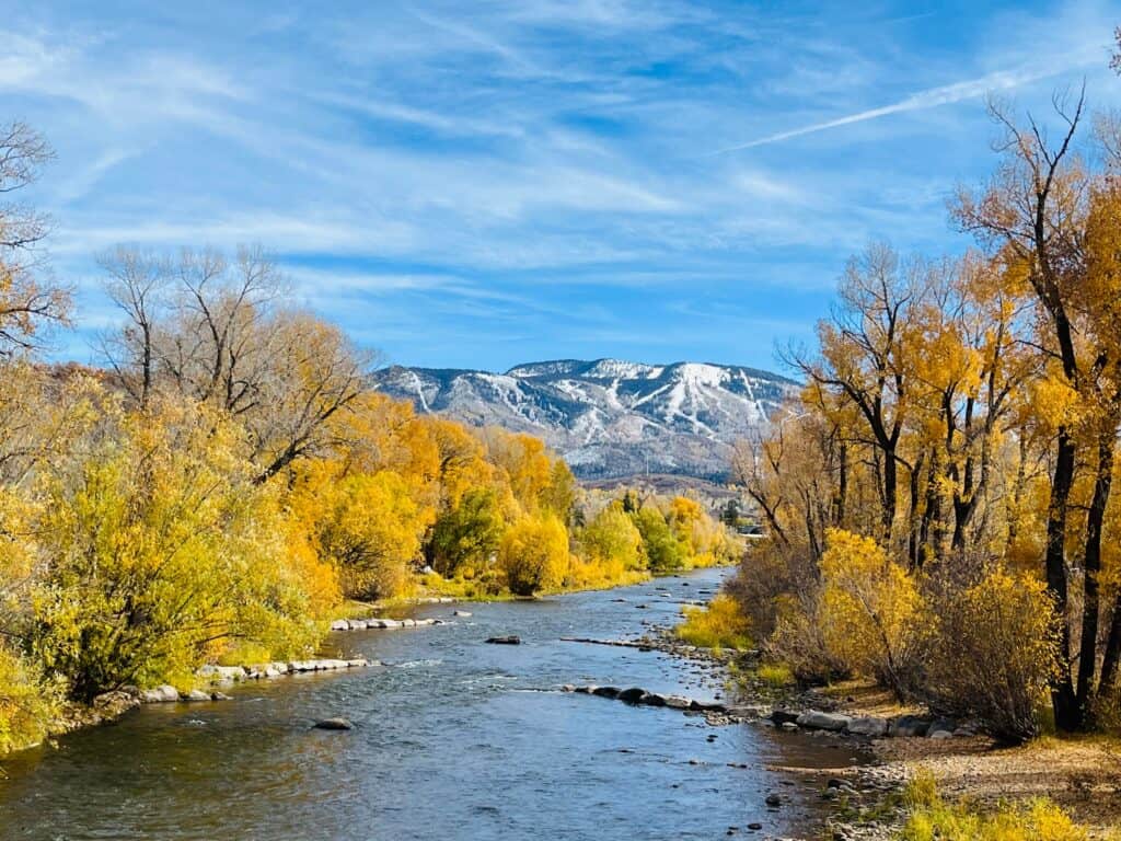
Rabbit Ears Pass is a scenic 19-mile stretch of U.S. Highway 40 that crosses the Continental Divide between Kremmling and Steamboat Springs. In the fall, the drive winds through aspen-filled forests and alpine meadows, with plenty of opportunities to see the leaves change along the way.
Cameron Pass
Located between Fort Collins and Walden, Cameron Pass is a high mountain pass sitting at 10,276 feet along Poudre Canyon Road (State Highway 14). The drive up to Cameron Pass is a beautiful way to experience Colorado’s fall colors, with golden aspen groves covering the mountainsides along the scenic route. The combination of vibrant foliage, towering peaks, and mountain lakes makes for an especially beautiful autumn drive.
Rocky Mountain National Park and mountains west of Boulder and Denver
Peak dates: September 13-24
Hikes:
Sprague Lake Loop
Distance: 0.8 Miles
Difficulty: Easy; loop
Fee: National Park entry fee
Location: Rocky Mountain National Park, Estes Park, Colorado
Sprague Lake Trail, located inside RMNP, is a family-friendly, easy loop that circles a small lake with views of the surrounding peaks. In the fall, the trees around the lake turn shades of yellow and gold, leaving their colorful reflections in the water. There are also plenty of tables and picnic sites along the loop, making it a great spot to enjoy a picnic among the fall colors.
Golden Gate State Park
Golden Gate Canyon State Park is a great place to take in Colorado’s fall colors, with more than 35 miles of trails through forests, meadows, and mountains. The park has trails for a variety of skill levels, from easy to difficult hikes. The Raccoon, Beaver, and Panorama Point trails are especially beautiful in the fall, when the aspen trees begin to change color.
Fourth of July Trailhead
Distance: Varies
Difficulty: Moderate
Fee: No fee
Location: Nederland, Colorado
Getting to this hike is a fall destination in itself. The 4th of July Road moves through the mountains near Eldora and has beautiful views of the surrounding forests and Indian Peaks Wilderness along the way. In the fall, the aspen groves along the road turn different shades of gold and the mountainside lights up with color. Once at the trailhead, there are a number of different trails you can take to continue seeing the fall colors on foot. Popular ones include Arapaho Pass, Diamond Lake Trail, and Arapaho Glacier.
Drives:
Trail Ridge Road
Trail Ridge Road is a 48-mile scenic drive through Rocky Mountain National Park that connects Estes Park and Grand Lake. In the fall, the lower portions of the road are beautiful as the aspen and other trees begin to change color. As you drive and climb higher, the forests give way to open alpine tundra, which offers a completely different view of the park.
If you plan to make the drive between 9 a.m. and 2 p.m., you’ll need a timed-entry reservation, which can be made online.
Peak to Peak Highway
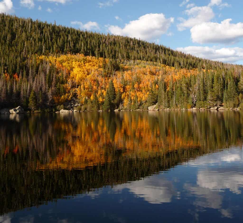
The Peak to Peak Scenic Byway is Colorado’s oldest scenic byway, stretching 55 miles from Black Hawk and Central City to Estes Park. The route passes through Golden Gate Canyon State Park and Nederland before reaching Rocky Mountain National Park. Along the route, you’ll have views of Indian Peaks and Longs Peak. Aspen trees light up the mountain valleys with gorgeous color, making this a beautiful drive with plenty of places to stop and enjoy the changing leaves.
You could easily make a full day out of this drive with stops to historic mining towns, hiking trails, and mountain scenery along the way.
Guanella Pass
The Guanella Pass Scenic Byway runs 22 miles between Georgetown and Grant, eventually climbing to 11,669 feet at Guanella Pass. The drive takes you from the historic mining town of Georgetown through forests and mountain valleys before reaching the alpine tundra. In the fall, the lower portions of the road are filled with changing foliage, while the higher elevations offer views of the colorful valleys from above. There are also several trails and scenic stops along the way.
Aspen, Vail, Summit County, and the central mountains
Peak dates: September 16-28
Hikes:
Pitkin Lake Trail
Distance: 9.9 miles
Difficulty: Hard
Fee: No fee
Location: Summit County, Colorado
Pitkin Lake Trail is a challenging hike near Vail that climbs from the valley through aspen groves and spruce-fir forests before reaching the alpine basin around Pitkin Lake. The trail begins with a steep climb, but the grade eases in sections as you pass waterfalls, open meadows, and mountain views along Pitkin Creek. In the fall, the lower portions of the trail are filled with changing foliage, while higher up, the landscape opens into the rugged alpine terrain surrounding the lake.
This hike requires a full day of hiking, so you will want to start early and plan for a long day. Alternatively, you can shorten the hike by hiking out in the valley and turning around before climbing toward the alpine basin.
Kenosha Pass
Distance: Varies
Difficulty: Varies
Fee: No fee
Location: Near Grant and Jefferson, Colorado
Kenosha Pass is one of the best places to see Colorado’s fall colors; it’s known for its large aspen groves that turn orange and gold in early fall. The trail follows the Colorado Trail east or west from the pass, and you can hike as far as you’d like before turning around.
If you’re mainly coming to see the fall colors, heading east will take you through aspen groves to scenic clearings with views of South Park Valley, with good views just over a mile into the trail. The trail also continues much farther (30+ miles!) for those looking for a longer hike or backpacking trip.
Ptarmigan Trail
Distance: 4.9 miles; out and back
Difficulty: Moderate
Fee: No fee
Location: White River National Forest, Silverthorne, Colorado
Ptarmigan Trail is a moderate out-and-back hike near Silverthorne that starts with a steep climb through open meadows before entering the trees and continuing toward a bench overlooking Dillon Reservoir and the Gore Range. The first section can be challenging, but the trail gets easier after the initial climb, and you don’t have to complete the entire hike to enjoy the views.
In the fall, the best foliage can be found around the middle of the trail, where the aspen trees add bright yellow and orange to views of the reservoir, Silverthorne, and the surrounding peaks.
Argentine Central Railroad Grade Trail
Distance: 5.6 miles; out and back
Difficulty: Moderate
Fee: No fee
Location: Clear Creek Canyon Open Space, Silver Plume, Colorado
Pavilion Point is a popular trail near Silver Plume that follows the old Argentine Central Railroad grade, which was once used to transport ore from the area’s mining towns. The trail climbs gradually through aspen-lined forest. Along the way, you’ll pass old mine shafts and railroad remnants before reaching Pavilion Point with views of Silver Plume and the surrounding valley.
Keep in mind that the trail runs near I-70 at the beginning, so you’ll hear some highway noise before it fades to quiet as you climb.
Watrous Gulch Trail
Distance: 5.6 miles; out and back
Difficulty: Varies
Fee: No fee
Location: Arapaho National Forest, Silver Plume, Colorado
Watrous Gulch Trail is a moderate hike near Silver Plume that climbs through forests and aspen groves before opening up into the alpine tundra. The first mile is extra beautiful in the fall, with changing foliage and views across the gulch. If you’re wanting a shorter hike, you can turn around here. If you want to keep going, the trail becomes much steeper during the final section as it climbs toward the saddle, making this a challenging but rewarding hike.
Drives:
Top of the Rockies
The Top of the Rockies Scenic Byway covers 83 miles between Copper Mountain, Leadville, and Aspen and crosses the Continental Divide three times. The route passes beneath Colorado’s two tallest peaks, Mount Elbert and Mount Massive, travels through the historic mining town of Leadville, and follows Twin Lakes before climbing Independence Pass toward Aspen. Fall is an especially popular time to make the drive, as the aspen groves and red maples bring color to the high-country landscape and surrounding lakes. Stop at the Independence Ghost Town Site along the way, where you can walk among old mining buildings and take in the fall foliage before continuing toward Aspen.
Highway 133 from Carbondale to Marble
The drive from Carbondale to Marble follows Highway 133 for about 28 miles south through the Crystal River Valley. On your drive, you’ll pass Mount Sopris, the historic town of Redstone, and the County Road 3 turnoff for Marble before climbing toward McClure Pass.
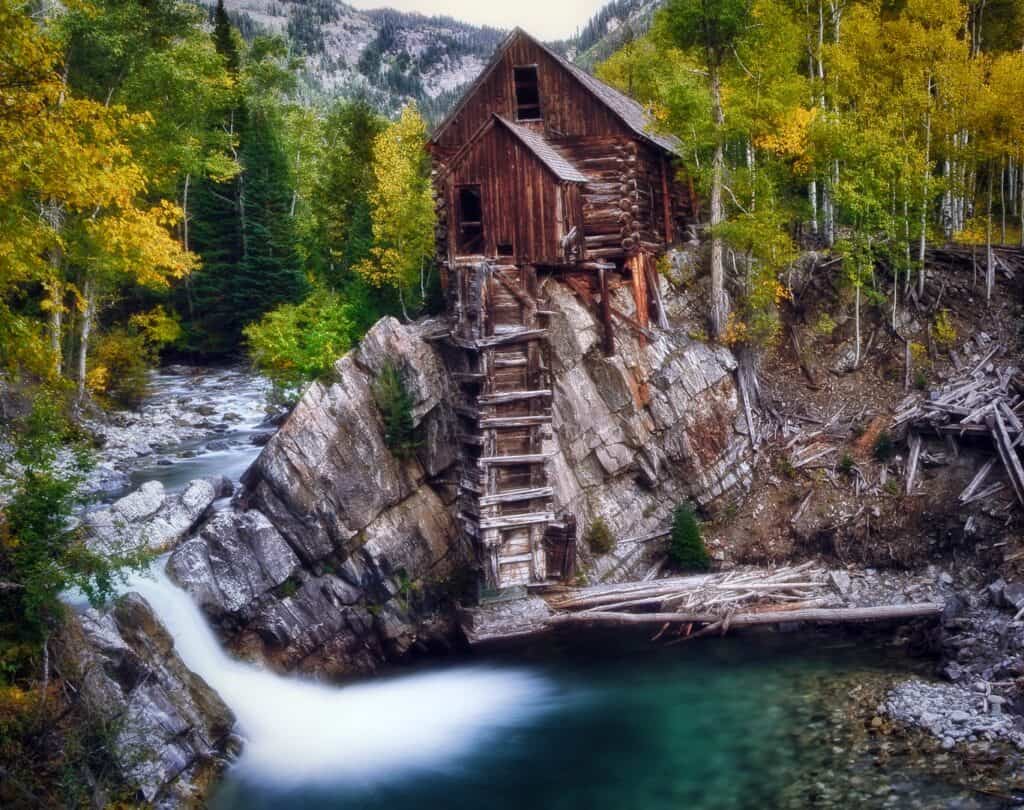
Fall is a beautiful time to make the drive as the yellow cottonwoods and aspen groves line the Crystal River and spread across the mountains. Be sure to take the 6-mile detour into Marble, where you can explore the small mountain town or continue toward the Crystal Mill, one of Colorado’s most photographed historic sites. From there, you can continue over McClure Pass for even more fall colors.
West Elk Loop
The West Elk Loop Scenic and Historic Byway is a long one and perhaps the ultimate scenic fall drive. It is a 205-mile route that circles the West Elk Mountains, taking you through Carbondale, Paonia, Hotchkiss, Gunnison, and Crested Butte. Along the way, you’ll watch as the landscape changes from the Crystal River Valley and orchards of the North Fork Valley to the Black Canyon of the Gunnison and the high country around Crested Butte.
Fall is the perfect time to make the drive because the entire route fills with changing cottonwoods and some of Colorado’s largest aspen groves. The route also passes through Kebler Pass, which is one of the best places to see the fall colors in the state. The full loop takes about 6–8 hours of driving, so plan on making a full day of it or breaking the route up with stops along the way.
Gunnison, Crested Butte, Telluride, and Ouray
Peak dates: September 18-29
Hikes:
Snodgrass Mountain
Distance: 6 miles; out and back
Difficulty: Moderate
Fee: No fee
Location: Crested Butte, Colorado
Snodgrass Mountain Trail, near Crested Butte, climbs through large aspen groves and open meadows with views of Mount Crested Butte along the way. The trail has a steep climb during the first mile, but this section also opens up to views of Mount Crested Butte and the valley below. From there, the trail continues through a large stand of aspens before opening into meadows on the return loop. In the fall, the aspen groves are one of the hike’s highlights, with sections of the trail surrounded by trees that turn bright shades of yellow and gold. You can also turn around at any point if you don’t want to complete the full hike.
Drives:
Kebler Pass
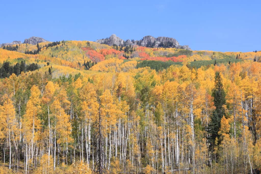
Kebler Pass is one of the most popular places in Colorado to see fall colors, with the state’s largest aspen grove covering the mountainsides along the road. The 30-mile drive connects Crested Butte with Highway 133 near Somerset, winding through the West Elk Mountains. In the fall, the aspens turn shades of yellow, orange, and gold, creating a long stretch of colorful scenery that makes the drive strikingly beautiful.
The road is mostly packed gravel and suitable for most vehicles with plenty of places to pull over and take in the foliage. Since this is such a popular spot, you might have the best luck going on a weekday rather than a weekend.
Million Dollar Highway
For what may be the most dramatic fall color drive in Colorado, head to the Million Dollar Highway. It’s a 25-mile stretch of U.S. 550 between Ouray and Silverton. The drive takes you through the San Juan Mountains and over Red Mountain Pass.
In the fall, the mountainsides come alive with golden aspens contrasting the rugged peaks, deep valleys, and red-streaked mountainsides. Along the way, you’ll pass old mining sites, abandoned structures, and the historic mountain towns of Ouray and Silverton. The Million Dollar Highway is already one of Colorado’s most spectacular drives, but seeing the San Juan Mountains covered in fall color makes it an unforgettable way to experience Colorado’s autumn scenery.
Pikes Peak, mountains west of Colorado Springs, and the southern Front Range
Peak dates: Sept. 23-Oct. 3:
Hikes:
Mueller State Park
Mueller State Park is home to more than 44 miles of hiking trails! It’s a great place to spend a fall day exploring the foothills around Pikes Peak. The trails range from short, easy walks to challenging hikes, with different routes passing through aspen and conifer forests, open meadows, ponds, and rocky outcroppings.
For an easier hike, try the Wapiti Self-guided Nature Trail. For a moderate option, there’s the Outlook Ridge Trail to Raven Ridge Overlook or the Aspen Trail Loop. Between the golden aspens, evergreen forests, open meadows, and views of Pikes Peak, it’s an easy place to spend a fall day hiking and enjoying some of Colorado’s changing scenery.
Drives:
Gold Camp Road
Gold Camp Road is a scenic dirt road that winds through the mountains west of Colorado Springs and eventually reaches the historic mining town of Victor. The road follows a former railroad route that connected Colorado Springs with Cripple Creek, and you can still see several of the historic tunnels along the way. While part of Gold Camp Road near Tunnel #3 collapsed in 1988 and is now closed to vehicles, the road continues west from its southern terminus at Old Stage Road toward Victor. This section is suitable for most passenger vehicles and takes about an hour to reach Victor.
In the fall, the drive takes you through forests of golden aspens and past rocky mountain scenery, with plenty of places to pull over, take pictures, and take in the views. Once you reach Victor, you can explore the historic mining town and see some of the remnants of Colorado’s gold-mining past.